|
|
|
| explore |
|
|
|
 |
|
|
|
|
|
|
|
|
|
|
|
|
|
|
|
|
|
|
 |
| |
|
|
|
|
|
|
|
|
|
|
|
|
|
|
|
|
|
|
 by Paul McHugh
They were hills, once. Fifteen thousand years ago
the islands of San Francisco Bay were tall pyramids cloaked in
green forests of cedar and pine. These hills jutted up from a
broad, rumpled plain, where Pleistocene bison and horses wandered,
as well as camels and saber tooth tigers. Valleys between the
hills were threaded by glittering creeks and one mighty river.
These streams wound through a huge, wooded basin, then out through
the Golden Gate, pouring themselves toward the Pacific Ocean.
At that point, much of North America was locked
under glacial sheets of the last Ice Age. These sprawling glaciers,
plus the swollen polar ice caps, slurped up so much of the Earth’s
water that ocean levels were 300-400 feet lower than they are
today.
After shooting the narrows of the Golden Gate,
those rivers had to wind westward another 32 miles before they
reached the sea. But then they scored a reward. The waters leapt
off a grand cliff that lay six miles beyond Los Farallones. That
soaring precipice was formed by the edge of the continental shelf.
This primeval cataract must have presented a scene of natural
splendor to rival the much-lauded Yosemite waterfalls.
If you were trying to count big Bay Area hills
during the last Ice Age you’d have to include that outlying
string of seven, storm-lashed granite peaks out by the waterfall,
since they were fully connected to the mainland back then. We
now call these eroded peaks the Farallon Islands – a variation
on the earlier, Spanish name. (It means steep, rocky peak or outcrop,
a very apt description.)
Today, the Farallons can be seen lying 26 miles
west of San Francisco, separated from the mainland by a broad
band of open sea. On clear, fogless days, they appear like a mirage
on the horizon. Their highly intermittent guest appearance may
be why local Miwok tribes considered this cluster of spectral
summits their land of the dead.
Because of Earth’s current global warming
trend, our most recent Ice Age remains in headlong retreat. The
Earth’s glaciers and ice floes continue to release waters,
feeding our rising seas. Because of that, some of the lower-lying
islands in our present-day San Francisco Bay may go underwater
in a century or two.
Station Island, Bair Island and The Sister Islands
may join the Bay’s Blossom, Arch, Shag and Harding rocks.
They’ll win a dark new status as they sink away from sunlight.
They’ll no longer be islands, but barely awash menaces to
navigation, to be marked by buoys and/or whittled by use of explosives.
Highly developed and populous Alameda Island,
if it is to survive, will likely need to transform itself into
our local Netherlands, diking itself off from the remorseless
advance of ever-higher tides.
Still, we can say that San Francisco Bay ...
..... purchase your signed copy today to
finish the introduction. It, and the thirteen chapters with their
richly storied captions, are sure to teach volumes about this
great Bay. |
|
|
|
|
Orders
are accepted through this site with instant
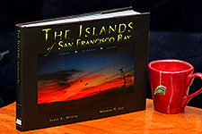
savings. The Islands of San Francisco Bay retails for $55 US
in stores.
Order
Here
to purchase books at a reduced price.
Get your copy today --
...learn more |
|
|